
About
Hongruixuan Chen is RIKEN SPDR Fellow at Geoinformatics Team, RIKEN AIP. He received his Ph.D. from the Machine Learning and Statistical Data Analysis Lab at The University of Tokyo, where he was fortunate to be supervised by Prof. Naoto Yokoya. He serves as co-lead of WG-MIA within the Image Analysis and Data Fusion Technical Committee (IADF TC). He was also an academic visitor at the Photogrammetry and Remote Sensing Group, ETH Zurich, and a former intern at The United Nations Satellite Center (UNOSAT).
His research uses machine learning and computer vision to make sense of multi-sensor Earth observation data. The work covers multi-sensor data interpretation, EO-specialized architectures, and label-efficient training, with foundation models for geoscience as a more recent thread. Applications span disaster response, land-cover mapping, urban planning, and environmental monitoring.
News
- 2026.10Recognized among the World’s Top 2% Scientists in the Stanford/Elsevier ranking (link).
- 2026.09Two papers have been accepted by NeurIPS 2026 (link 1, link 2).
- 2026.08Our book chapter on disaster response is now available online (link).
- 2026.07Acting as Guest Editor in Remote Sensing (link 1, link 2).
- 2026.07Awarded a Grant-in-Aid for Research Activity Start-up.
- 2026.07Acting as Guest Editor in Geo-Spatial Information Science (GSIS).
- 2026.07One paper has been accepted by IEEE TGRS (link).
- 2026.06One paper has been accepted by ISPRS J P&RS (link).
- 2026.05The 2025 IEEE Data Fusion Contest winning-solutions summary paper has been published in IEEE JSTARS (link).
- 2026.05BRIGHT and HyperSIGMA have been awarded as ESI Hot Paper.
- 2026.05Our review paper Earth Observation for Disaster Mapping: Benchmarks, Methods, Challenges and Future Perspectives is online now (link).
- 2026.05Nominated as a judge for the Outstanding Student and PhD candidate Presentation Awards at EGU26.
- 2026.04Joined RIKEN AIP as a RIKEN Special Postdoctoral Researcher (基礎科学特別研究員).
- 2026.03We launched the BRIGHT Challenge at CVPR 2026 MONTI (link).
- 2026.03Awarded the UTokyo President's Award. I am really grateful to Prof. Naoto Yokoya for his continuous guidance and great support (link).
- 2026.02Three papers have been accepted by CVPR 2026 (link 1, link 2, link 3).
- 2026.02One paper has been accepted by ISPRS J P&RS (link).
- 2026.01One paper has been accepted by JAG (link).
- 2026.01One paper has been accepted by IEEE TPAMI (link).
- 2025.12Two papers have been accepted by ISPRS J P&RS (link 1, link 2).
- 2025.11BRIGHT has been accepted by ESSD (link).
- 2025.10One paper has been accepted by NeurIPS 2025 (link).
- 2025.09Appointed as Co-Lead of Working Group on Machine/Deep Learning for Image Analysis (WG-MIA) of IEEE GRSS (link).
- 2025.08OpenEarthMap-SAR has been accepted by IEEE GRSM (link).
- 2025.08One paper has been accepted by ISPRS J P&RS (link).
- 2025.07I successfully passed my Ph.D. defense. Many thanks to everyone who supported me along the way.
- 2025.01BRIGHT and OpenEarthMap-SAR serve as the official datasets of IEEE GRSS Data Fusion Contest 2025 (link).
- 2024.10Acted as a Special Issue Editor Associate at Remote Sensing (link).
- 2024.09SynRS3D selected as Spotlight (top 3.1%) at NeurIPS 2024 (link).
- 2024.07Two oral presentations (SAM-MapCD, OpenEarthMap Benchmark) at IGARSS 2024.
- 2024.06ChangeMamba has been accepted by IEEE TGRS (link).
- 2024.06ObjFormer has been accepted by IEEE TGRS (link).
- 2024.04Awarded the JSPS Research Fellowship for Young Scientists (DC2), selection ratio 17.1%.
- 2024.03Co-organised the OpenEarthMap Land Cover Mapping Few-Shot Challenge at CVPR Workshop 2024.
- 2024.01Started a six-month academic visit at the Photogrammetry & Remote Sensing Group, ETH Zürich.
Selected Papers
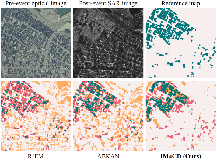
Multimodal remote sensing change detection: An image matching perspective
ISPRS Journal of Photogrammetry and Remote Sensing, 2026
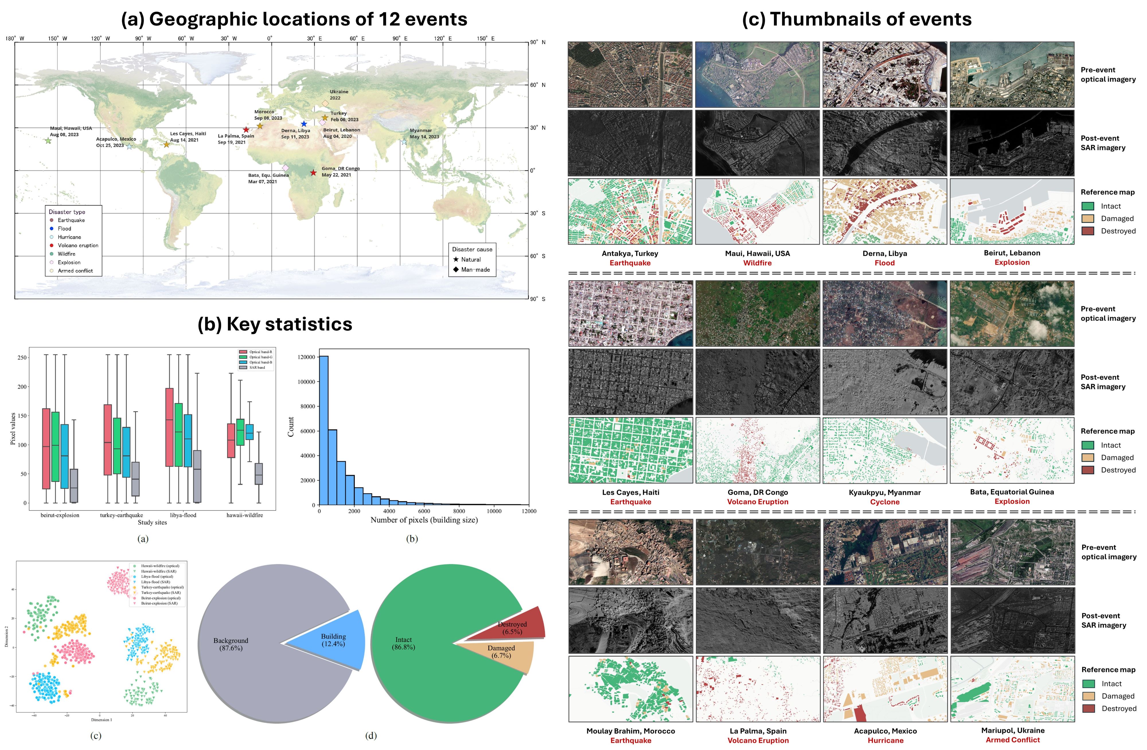
Earth System Science Data (ESSD), 2025
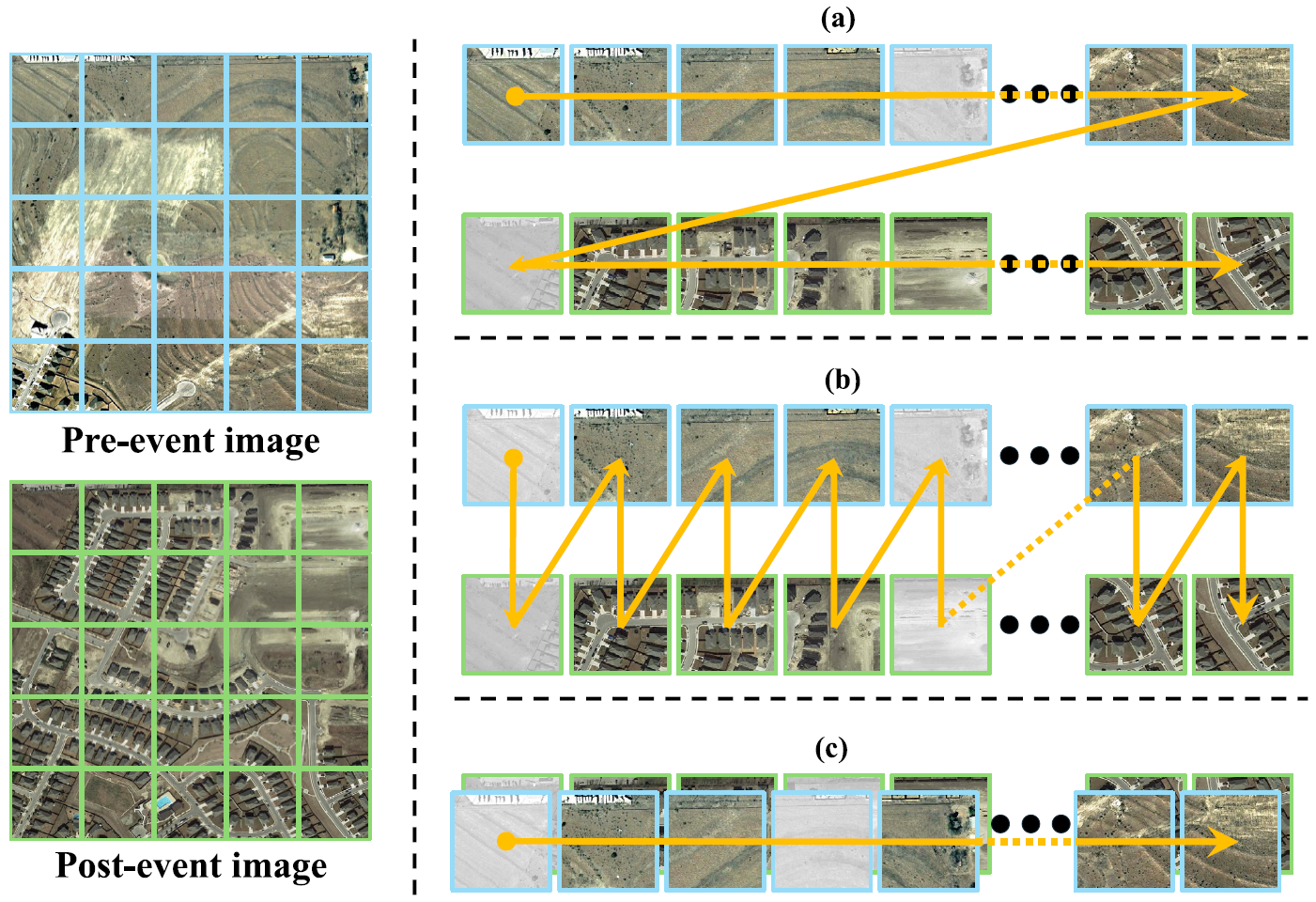
ChangeMamba: Remote sensing change detection with spatio-temporal state space model
IEEE Transactions on Geoscience and Remote Sensing (TGRS), 2024
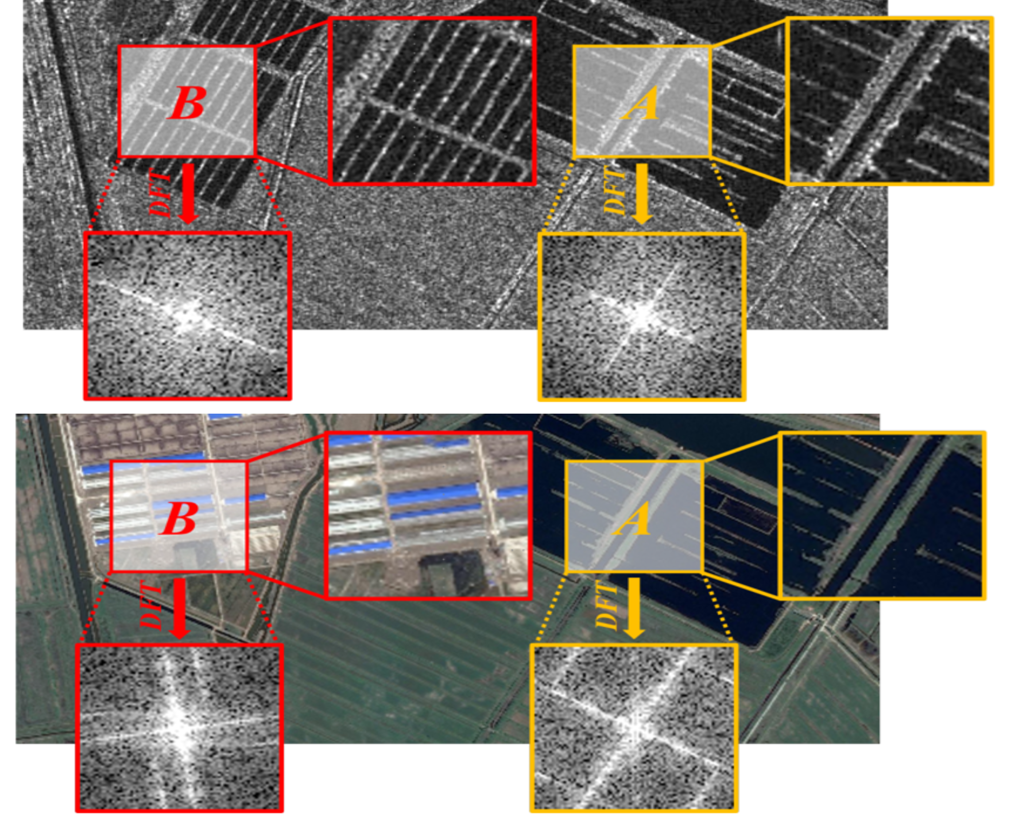
Fourier domain structural relationship analysis for unsupervised multimodal change detection
ISPRS Journal of Photogrammetry and Remote Sensing, 2023
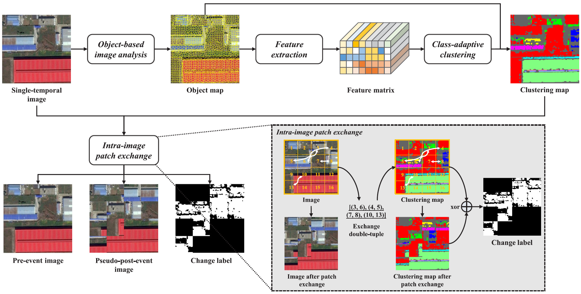
ISPRS Journal of Photogrammetry and Remote Sensing, 2023
Experience
Work & Overseas Experience
Education
Fundings
Services
Community Service
Editorial Activity
Reviewer
- IEEE Transactions on Pattern Analysis and Machine Intelligence (TPAMI)
- IEEE Transactions on Image Processing (TIP)
- IEEE Transactions on Circuits and Systems for Video Technology (TCSVT)
- IEEE Transactions on Neural Networks and Learning Systems (TNNLS)
- IEEE Transactions on Geoscience and Remote Sensing (TGRS)
- IEEE Transactions on Multimedia (TMM)
- International Journal of Computer Vision (IJCV)
- Remote Sensing of Environment (RSE)
- Earth System Science Data (ESSD)
- ISPRS Journal of Photogrammetry and Remote Sensing (P&RS)
- Medical Image Analysis (MedIA)
- Information Fusion (InfFus)
- International Journal of Applied Earth Observation and Geoinformation (JAG)
- IEEE/CVF Conference on Computer Vision and Pattern Recognition (CVPR)
- European Conference on Computer Vision (ECCV)
- Annual Conference on Neural Information Processing Systems (NeurIPS)
- Other 50+ journals & conferences ...
Awards & Honors
- 2026 — UTokyo President’s Award for Academic Achievement
- 2026 — UTokyo GSFS Dean’s Award for Academic Achievement
- 2025 — JSPS Research Fellow’s Special Allowance (Research Incentive Grant)
- 2024 — Japan Society for the Promotion of Science (JSPS) DC2 Research Fellowship
- 2023 — Japanese-Swiss Young Researchers' Exchange Programme Special 2023 Exchange Grant
- 2022 — The University of Tokyo Fellowship (Todai Fellowship)
- 2022 — Outstanding Graduate Student, Wuhan University
- 2021 — Wang Zhizhuo Innovation Talent Scholarship, Wuhan University
- 2021 — National Scholarship for Postgraduates, Ministry of Education
- 2021 — First Prize of Academic Scholarship, Wuhan University
- 2021 — Outstanding Graduate Student, Wuhan University
- 2020 — National Scholarship for Postgraduates, Ministry of Education
- 2020 — First Prize of Academic Scholarship, Wuhan University
- 2020 — Outstanding Graduate Student, Wuhan University
- 2019 — LIESMARS Scholarship for Excellent First-Year Postgraduates
- 2019 — Excellent Graduate of Anhui Province
- 2018 — First Prize of Academic Scholarship, Anhui University
- 2018 — Second Prize, Esri Cup GIS Software Development Contest in China
- 2018 — Outstanding Prize, National Geomatics Contest in Programming
- 2018 — Meritorious Winner, US Mathematical Contest in Modeling
- 2017 — Second Prize, China National Mathematical Contest in Modeling
- 2017 — National Scholarship for Undergraduates, Ministry of Education
- 2016 — Anhui University Scholarship for Excellent Students
Resources
Visitors
– unique visitors · – total views